Geospatial, re-envisioned
See the change you want to make in the world
Join the early adopter community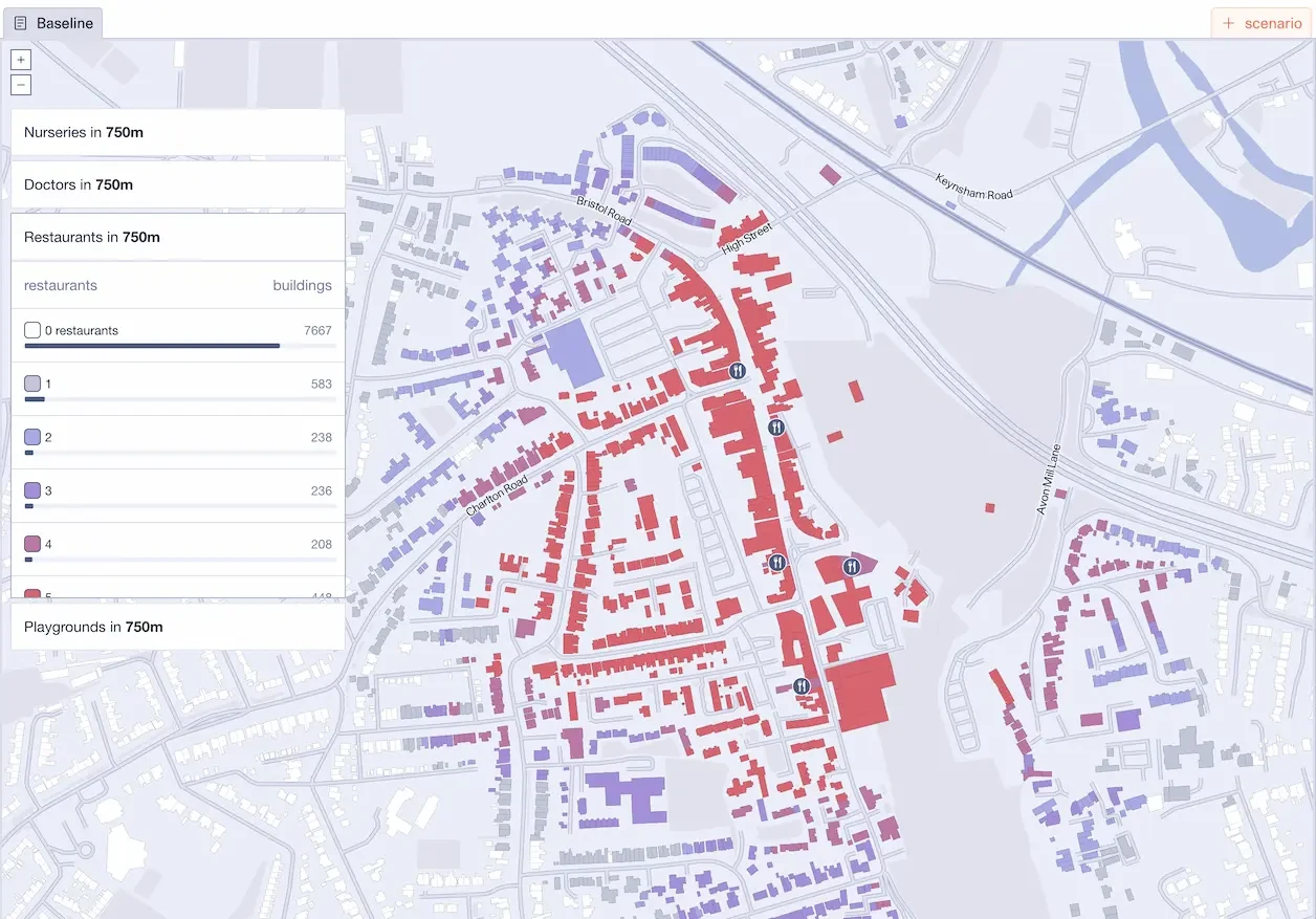
The data visualisation platform for holistic place analysis
Optimise the way you plan and design with Skyline. Tailored for built environment professionals, our platform speeds up scenario testing and showcases data in dynamic maps.
Experience quicker decision-making, effective collaboration, and the power to realise ambitious projects with clarity and confidence.
Research the ‘what if’, then show the 'why’.
What would you do if you could enhance your design proposals and projects with rapid scenario testing, beautiful visualisations, and easy sharing of outcomes?
With its intuitive interface and advanced scenario modelling, Skyline lets you do just that, without the need for extensive data analytics expertise.
Features
Skyline is a geospatial data visualisation platform that lets you:
1
Visualise spatial analysis
Effectively communicate complex spatial information to stakeholders through beautiful and interactive maps. This allows for seamless collaboration and sharing of results, ultimately leading to better decision-making and outcomes.
2
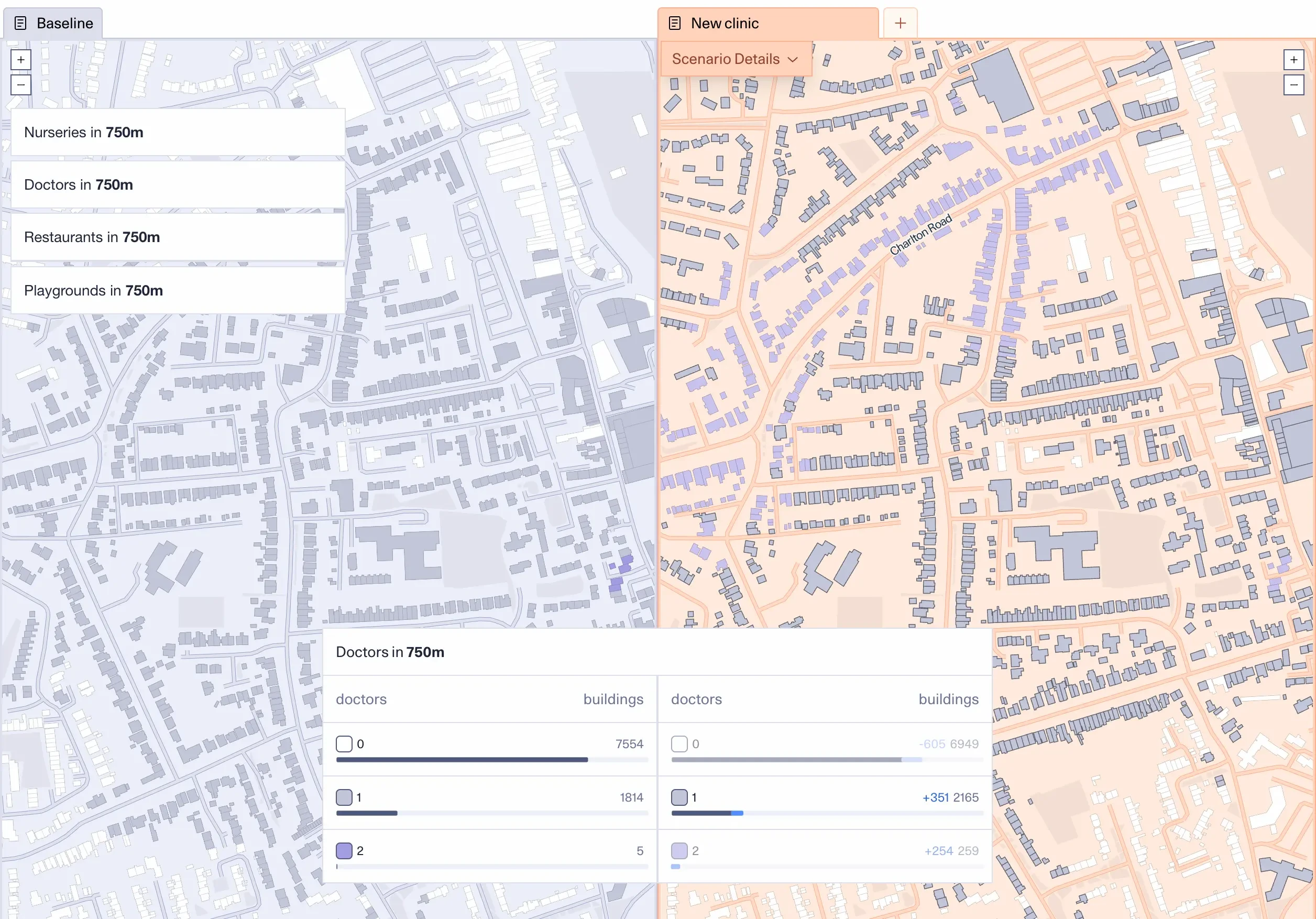
Explore place interventions
Experiment with various spatial scenarios and evaluate their consequences, utilising advanced geospatial data analysis. Make informed decisions and optimise your projects accordingly.
3
Integrate and combine different datasets
Skyline is data agnostic. It allows you to combine multiple datasets under a single holistic platform.
Be the first to use Skyline
A beta version of Skyline is currently being tested by a select group of people. Would you like to be the next to try Skyline? Then sign up to our early adopters community.